Category Archives: OSMF

Posts about organisation of the OpenStreetMap Foundation. Working groups, the board, and other entities, and how we structure our organisation

Play a role in shaping OpenStreetMap

This year, OpenStreetMap reached the milestone of 1 million map contributors. Did you hear about the amazing sessions and everything interesting happening at the State of the Map conferences happening across the globe? This community is growing — what will make this journey better? YOU being a part of it.

If you are a map enthusiast, working hard to keep OpenStreetMap up-to-date, participate and organise mapping events, love teaching folks the nitty gritty of OpenStreetMap, share and write diaries or blogs about OpenStreetMap — if you aren’t a member already, then you should join up and support the OpenStreetMap Foundation

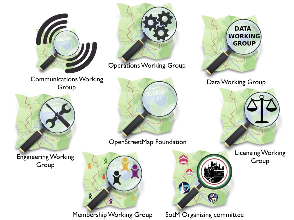
OSMF Working Groups

We’re running a membership drive from now until mid-November. Sign up now. We are already 800 members worldwide! You can help by liking, retweeting, or spreading the word about the Membership Drive to friends or at local events/conferences.

Some questions that you might have:

Why should I join?

  • Keep OpenStreetMap’s servers running: OpenStreetMap is the world’s biggest user-generated map, free for everyone to use.
  • Support our volunteer working groups: Our Working Groups keep OpenStreetMap safe from vandalism and legal threats, resolve licensing issues, organise conferences, keep our hardware and software up to date, and many other things.
  • Enjoy discounts to OSM events: The annual State of the Map conference offers significantly cheaper prices for OSM Foundation members.
  • Show your support for OpenStreetMap.

What are the things that I could do once I become a member of OSMF?

  • You’ll have an official voice in the governance of the Foundation — the organization which owns and maintains the servers, holds the license, runs the State of the Map, coordinates local chapters.
  • Influence the future direction of the project.
  • Vote in the annual OSM Foundation elections for the board that steers the project.

I’d like to join but there’s currently no suitable money transfer facility for me

A membership fee waiver policy will be implemented soon – stay tuned!

OSM condemns recent anti-semitic vandalism

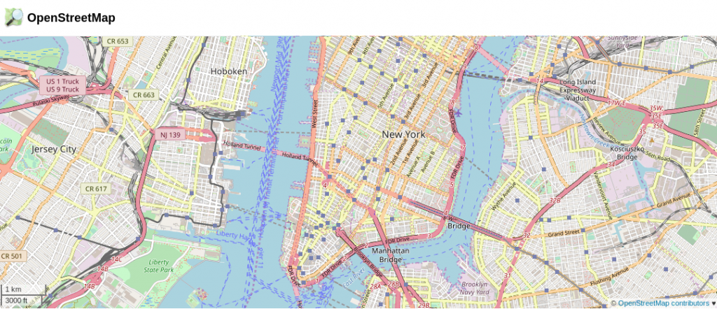
Earlier today news surfaced of various online maps displaying an anti-semitic term instead of the label “New York”. Unfortunately we have to confirm that this data originated with our editable map project. This vandalism was detected and fixed within 2 hours, and the vandal was blocked from contributing further to OpenStreetMap.

On behalf of our organisation and community, OpenStreetMap condemns this kind of antisemitic hate speech without hesitation. We are disappointed that our project, which is devoted to sharing knowledge, was turned into a vehicle for the expression of ignorance, and hate. How did it happen?

Part of the “Open” of OpenStreetMap, is being openly editable. It is a wiki-style, crowd sourced, collaboration in which users all around the world can contribute and make edits. As with wikis, like Wikipedia, all changes are published immediately, and we put tools into the hands of our community to monitor each other’s changes and revert vandalism. This “soft security” approach may sound surprising, but over the years we’ve found, as something of a triumph of human nature, that the vast majority of editors want to come together to help build something great, and these massively outnumber the few bad apples. OpenStreetMap is a not-for-profit good cause, and the map data is “owned by” the community. On the whole people tend to have respect for that.

In fact this vandalism happened a month ago, but delayed processing of data updates by some companies downstream, in this case Mapbox, which presents our maps to thousands of apps and websites –means that this vandalism was seen quite widely today. Mapbox has posted their response to the incident here. There is on-going work within the OpenStreetMap community to develop better quality assurance tools, to detect and deal with this sort of issue faster. Mapbox has been spearheading these initiatives both in terms of developing vandalism detection software, and committing staff toward the efforts of monitoring and reverting bad edits. Unfortunately human error in their processing pipeline led to this incident in OSM-based maps that Mapbox provides to companies like Snapchat.

If you see vandalism on our map, you can help. Read more about vandalism here. We will continue to work with our community and data consumers to make our map even stronger.

Thoughts on the OSMF Face-to-Face Board Meeting 2018

Like 2016 and 2017, the OSMF board had a face-to-face meeting again this year. This time, we met in Karlsruhe, Germany, at the office of Geofabrik. Meeting at Frederik’s and Christine’s place was a great choice and Frederik was a great host. In addition to having plenty of room to talk and work we even got home-made cheese cake from Christine (thank you!).
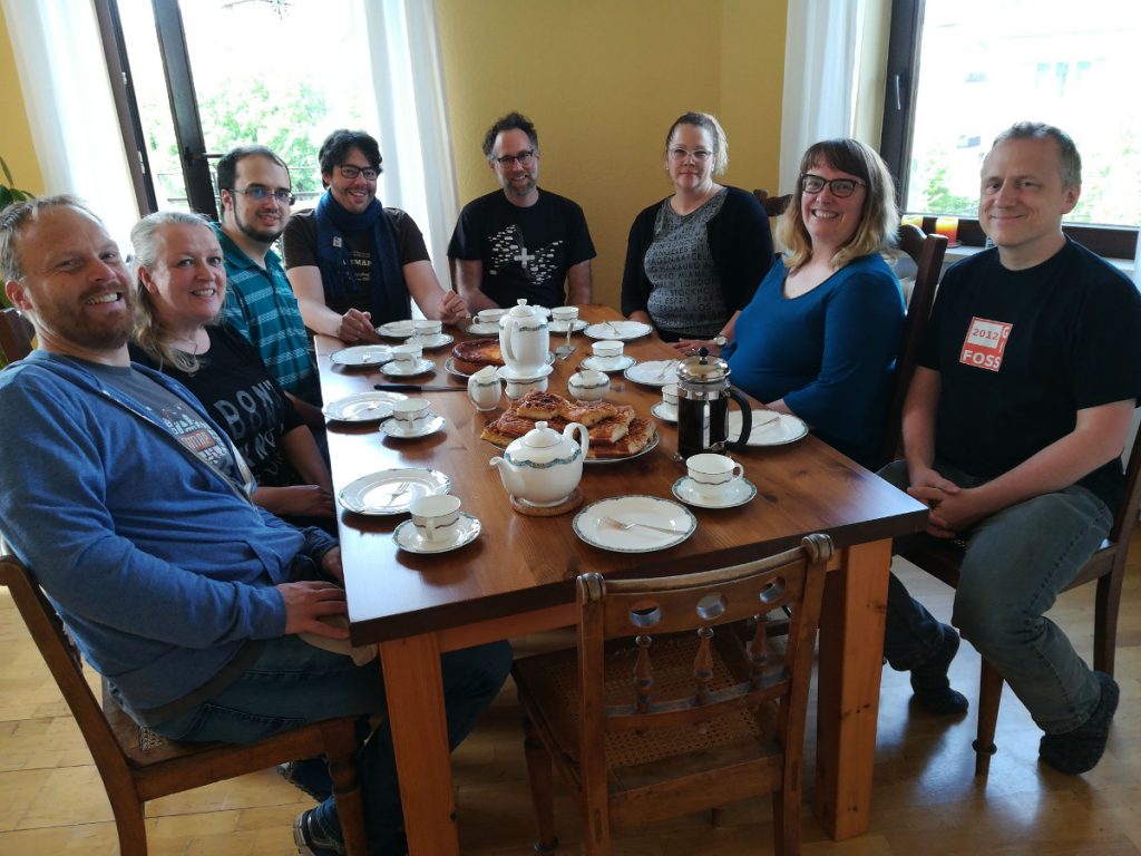
OSMF Board eating cheese cake after an invitation by Christine. © CC-BY-SA Dorothea

I had a short trip by car and arrived on Friday, 27th of April in the late afternoon and the official schedule started Saturday morning. Most of my colleagues, who had to take a longer trip by plane, arrived early on Friday or even Thursday and thus had the chance to meet at Frederik’s place for some early preparations and working on some OSMF stuff.

I don’t consider this post a detailed summary of what happened and what was talked about. It’s more about my thoughts about the meeting and about the most prominent topics we talked about. There will be more detailed minutes at a later stage.

Preparation

Like in previous years, we filled in a small questionnaire about our expectations and plans for this face-to-face meeting and once again it was Mikel who did a great job collecting the input and assembling a schedule for us. The schedule was less tight than in past years and we deliberately left some space for some last-minute topics. We also had some topics where it wasn’t clear if we could make it in the time set, so it was good to have some space for that.

Social interactions

One of the more generic recurring goals was to understand each other’s points of view, work and communication styles. I kind of find it funny how much such a meeting helps in that regard as it’s still a huge difference between reading, hearing and also seeing someone to get to know them better. And while most of us have met before, I think I still gained from it. Additionally it was Heather’s first meetup with the rest of us, so I took the chance to get to know her better.

On the mailing list we were asked about the value of the meeting, if it’s worth it. And as every year I feel the pain of giving a concrete answer to that. It’s hard to measure it as you don’t have any revenue to compare against. Anyway, I think the social aspect of the meeting is an important one. “Did they want to offend me?”, “Are they serious about that or was that a joke?”,… knowing someone in-person makes it easier to understand and classify a response. This makes overall communication easier and more productive I think. And given our organizational budget compared to the money spent, I guess my suggestion for future boards would be to just have a face-to-face meeting by default, without trying to ponder about its value.

Conflict of Interest

The topic about conflict of interest (COI) was a very difficult one and I felt the urgent need to talk about it early on. I thought that some other topics might pose a COI for some of us, so we should talk about COI first.

The problem that I have is that it’s very easy to construct a scenario where something might be a potential conflict of interest and as I wrote in a similar discussion on osmf-talk mailing list, you could easily argue that Mikel, as an employee of Mapbox, kind of always has a potential COI. Rightly Mikel told me, that it’s not hard for him to construct a case making me have a potential COI as well, for whatever topic we talk about.

I seemed to be very passionate about that topic as I got asked several times to explain myself and that the others perceived me as having a strong opinion on it. I actually did not, I had a lot of questions and I felt the need to answer them. We discussed the topic for quite some time, but only very few questions could be answered. Anyway, we agreed that we should have a guideline at some point. Until then, I’d like to invite you to take part in that discussion and share your thoughts on our mailing list. We are supposed to support the community and value their input.

The second conclusion was, that we could use some professional help. That’s why we wrote a mail to “our” lawyer to clarify some of the questions we had. E.g. the legal text about COI speaks about a COI if a person is director in two companies, which basically only applies to Frederik and Kate at best. But what about if you’re an employee in one company and director in the other, like e.g. Mikel or Martijn. The law reads as if that can’t be a COI. So independent of our guideline, such questions should be answered first and I hope we’ll be able to share them with the community soon.

Micro Grants

We had talked about micro grants before and somehow didn’t follow up or finish it. As I said, some of us had been in Karlsruhe on Thursday or Friday, so they took the chance to start working on it at that point in time and we continued to work on it on Saturday and Sunday together. I guess in the end we have a pretty decent plan.

I can’t estimate if micro grants will be successful or not, but I think that it’s a good idea to have something like that and to encourage people to take place in it. In the German chapter, the FOSSGIS e.V., we have something similar and in my opinion it has been proven to be quite valuable, so I hope the OSMF micro grants prove to be a similar success.

Anyway, I guess some more details will pop up on the mailing list soon and the program is scheduled to start at this year’s State of the Map.

Working Groups and Volunteers

This is the second topic we resumed from last year and I’m getting a bit emotional about that one. I love the OpenStreetMap project and its community, the amount of volunteering time spent on the project and the output, our great database and map.

Still I find it very sad that only very few people spend their time on helping to run the project. Almost all working groups suffer from a lack of volunteers, only very few people help developing code for the core services, almost no one participates in organizational discussions about the project and so on. So if you’re reading this post you most likely are not in a working group. Why? It’s so easy to join and help!

Anyway, we talked about ideas how to solve that and how to get volunteers to help. It was a tough topic and I think I was not really enthusiastic about any of the ideas. And in the end I felt the need to abstain from further discussion. I can’t say if there’s a conclusion to that, but one thing we felt is the need to better identify the needs of working groups. I guess it’s not obvious for everyone how much we lack volunteers to keep the project running.

Diversity and Communications

The diversity and communications topic was something I was afraid of as I considered everyone having a very strong opinion on that. At least I have. I thought we’d get into a fight over that, but all of us left without a black eye.

As I said in the begining, these are my thoughts and my opinions, so I don’t want to get into too much detail. But if I read e.g. this code of conduct, my blood pressure rises. I consider it very unfair, I can’t stand rules that know who’s guilty in advance and that consider insults acceptable if they are coming from the correct set of people. I also
dislike how the issue is often approached with a clearly defined “desired outcome”, instead of openly discussing real problems and their potential solutions.

Still, the discussion was not so bad after all. We split up into two smaller groups and I discussed with Frederik, Mikel and Kate and it was interesting to hear their opinions on it. I especially appreciate talking with Kate about it. She’s kind of passionate about the topic and she is able to provide very good examples and insights and she’s amazingly patient with people who ask silly questions :-). It helped me very much understanding other points of view. It didn’t change my mind though but I think the discussion gains much from people like her.

GDPR

The GDPR is a very important topic as it starts taking effect soon. We talked quite much about it and Heather took the lead on it. She was very well prepared and put considerable time into it. I think she’s also concerned with it in her professional life, so she knows what she’s talking about. I had some reservations that from the outside it would look like we’d overrule the LWG, but we ended up mostly devising strategies for the bits that fell outside of LWG‘s responsibility, and otherwise agreeing with their recommendations.

You can read more on the topic at several places, but I guess the most comprehensive information or summary can be found in Heather’s blog post here

Summary

I will abstain from a judgement on whether the meeting is worth the money or not. As Frederik put it some time back: We should just make it default to have a face-to-face meeting and that’s my suggestion for the boards to follow as well.

I think we did get some things done and meeting in person makes it easier, quicker and more productive. As I said above, I hope we’ll gain as a project from the micro grants. I also hope that we started a process to get a guideline for the conflict of interest and I’m eager to read the lawyer’s reply. I deliberately didn’t include details, as you’ll be able to read them in the minutes anyway. But I somehow hope that my post furthers the interest in our project and organizational topics. Please participate in the discussions and share your thoughts.
How the new Niantic – OpenStreetMap Foundation collaboration affects mappers coming from Pokémon GO

Happy April 1st everyone! We would be really happy if this announcement was real (but it’s not 🙂 ). We still want to encourage everyone to add correct information to the map, read the links with the tips (1, 2) and get more involved. Many thanks to all Pokémon GO trainers who have correctly mapped their areas. Happy mapping!

OSM logo by Ken Vermette, Pikachu image CC BY-NC.

During the last year the OpenStreetMap community has seen an influx of mappers coming from Pokémon GO, as the hugely popular mobile game was found to be using OSM data to influence “spawn points” within the game. New mappers were welcomed and we shared some tips with them. We got a few people addicted to mapping, new places were mapped and help received a lot of questions. The flurry of new map editing activity also had some unfortunate side-effects, as a few new mappers tried to game the system by adding things that did not exist or by assigning the wrong tags.

Use of leisure=park from 2013 to 2018. Source: http://taghistory.raifer.tech/


The OpenStreetMap Foundation has been in contact with Niantic and we are in the happy position to announce a collaboration! Niantic, wanting to show their support to the project, will become our first Rubidium Corporate Member and is also in the process of adjusting their algorithms so that areas with good map edits get more spawn points, while areas where players try to game the system get penalised. While the implementation will be gradual, it will take into account all edits that have happened in an area for the last 1.5 years and it will use a scoring system to determine the increase (or decrease) of spawn points. That means that the good mapping habits of you and your nearby players can positively affect your game.

“Niantic is in the process of adjusting their algorithms so that areas with good map edits get more spawn points, while areas where players try to game the system get penalised.”

What you can do:
Read our tips.
Read recommendations collected from community members.

In addition to that, there are plans to reward other contributions to OpenStreetMap as well. To begin with, for every accepted pull request to core software of the OpenStreetMap infrastructure, the trainer will be rewarded with an unique opportunity to obtain some legendary Pokémon – including those which were up to now only available during limited-time events! At a later stage, we’re planning to use a more elaborate algorithm, which may also include the trainer’s wiki profile, help karma points and other contributor metrics, so stay tuned! The OSMF has approached the creator of the popular “How did you contribute” service, Pascal Neis, to work with Niantic to find  the most effective way to determine a trainer’s score.

We encourage all players of Pokémon GO to take advantage of this early release statement and go out to map, write code or help to enhance the wiki pages!

Pokémon GO is a hugely popular mobile game which uses OpenStreetMap data to influence “spawn points” within the game. It always takes new folks some time to get to know OpenStreetMap, and we hope Pokémon GO players will stick around to contribute some more.
OpenStreetMap is a world-wide collaborative project aiming at providing free map data, under an open license, to anyone who wants it. Volunteers all over the planet contribute their local knowledge and their time to build the best map ever. You can contribute by improving the map, uploading GPS traces, increasing awareness about the project, editing or translating the wiki, becoming a member of the volunteer Working Groups, donating or joining the OSM Foundation. You don’t have to be a member of the Foundation in order to edit OpenStreetMap.

OSMF Request for Proposals: Data Centre 2018

Photo by cosheahan on flickr. Licence: Attribution 2.0 Generic (CC BY 2.0)

Statement of Purpose

The OpenStreetMap Foundation (OSMF) Operations Working Group (OWG) is looking for proposals to provision space in a data centre to continue to run the OpenStreetMap (OSM) project’s infrastructure.

Background Information

OSMF is a nonprofit organisation dedicated to supporting, but not controlling, the OpenStreetMap project. OSMF created the OWG in order to support OSM’s technical infrastructure, including the main website, API, data distribution, community sites, and manage them for the benefit of the project.

The map data created by OpenStreetMap and distributed through ​OSMF​ is the best free global map available. It powers services all over the world, including for companies such as Apple, Foursquare, Craigslist and Mapbox. Ple​ase see https://www.openstreetmap.org/about​ for more background information.

Scope of Work

The data centre provider must meet the requirements set out below.

Requirements

Primary

●  The data centre must be in the EU.
●  One rack (at least 40U) of space, at industry standard rack dimensions.
●  Power capacity at least 3kW w/ dual redundant supplies.
●  Cooling to keep the servers suitably cool, e.g: under 35 degrees celsius.
●  Secure cages, so that only access authorised by the data centre or OSMF is possible.
●  On-site “remote hands” to be able to receive and replace HDDs and press power buttons during weekday business hours and at least some service weekends and holidays.
●  Network connection capable of 1Gbit/s peak traffic and 500Mbit/s sustained.

Secondary

●  Control over the configuration of any upstream firewalls for the purposes of ensuring necessary ports are open.
●  Good peering connection to major European backbone network. Ideally within 20ms of our existing sites on JANET.

Additional questions

Please provide detailed information on:
●  The procedure for shipping parts to the data centre, and
●  The procedure for raising a ticket for “remote hands” work, and
●  Whether “remote hands” would be available outside of business hours, and
●  The site’s uptime and network reachability over the past year, and
●  The procedure for an OSMF representative to visit and access the data centre.

Term of Agreement

The agreement would start on or before 1st April 2018 and run for a minimum of 3 years (at
OSMF’s option), preferably renewable annually or on a longer basis after that. Any renewal or
cancellation on either side would need a minimum notice period of 3 months.

Terms and Conditions

If you have Terms and conditions or Acceptable Use Policies then you should submit them in editable form for legal review, where possible. T&C/AUP changes should be expected to ensure we meet the privacy and security commitments required for our users.

Schedule, Evaluation and Award Process

This RFP is expected to be open until 28th February 2018. Only applications received prior to this date can be considered for this RFP. All proposals will be received in confidence and will be kept private.

After the date above, all proposals will be evaluated by the OWG against the requirements set out above, after which OWG may contact candidate sites with follow-up questions or to arrange site visits. The final agreement will require legal review and approval by the OSMF board.

OSMF particularly welcomes responses from anyone willing to support the work of the foundation at minimal cost.

The successful candidate will be publicly thanked on the main OSM project website as well as OWG websites in accordance with OWG’s Hosting Provider Credit Policy.

Points of Contact

Many thanks for your interest. If you have any questions or proposals, please send them to
operations@osmfoundation.org​.

OpenStreetMap Receives Large Donation from the Pineapple Fund!

Pineapple Party

We’re celebrating the generous donation from the Pineapple Fund to the OpenStreetMap Foundation. Party.

Only two weeks ago we were amazed to see a large bitcoin donation of over 2.3 BTCs, worth €30,000 (£27,000) and asked ourselves where this donation might originate from. There had been different ideas, but we’re still clueless.

Some suggested that this was the Pineapple Fund donating to us. But only today we learned it wasn’t them as we received a second donation, this time indeed from them. They sent us the amazing amount of 18 Bitcoins, currently worth over €200,000! Yay!

What is the Pineapple Fund?

The Pineapple Fund was created by an anonymous (privacy-loving) person that goes by the username Pine who invested in the really early days of Bitcoin, and is now one of the 250 richest bitcoin holders. They generously decided to establish the Pineapple Fund, as “once you have enough money, money doesn’t matter” and to donate $86 million worth of Bitcoins to all kind of charitable organizations. Read more about their mission statement on pineapplefund.org. If you scroll down a bit you’ll find a list of organizations that already got a donation and the list now contains our project as well. They also link to different news covering their story.

What is Bitcoin?

Bitcoin is a cryptocurrency and an innovative digital payment network which started back in 2009. It is based on cryptography to secure any payments and has a public ledger to document any payments made. As it is based on a public peer-to-peer network, anyone can participate and no central server or instance is needed.

Bitcoin received broader media attention lately as the fiat exchange rates have risen by some hundreds of percents last year, making one Bitcoin worth more than €10,000 as of today.

For more details you may want to have a look at bitcoin.org, which also features a nice introductory video.

Why OpenStreetMap?

The Pineapple Fund explained on reddit that “$250k go to OpenStreetMap, because geographic data for our world should be freely available, without restrictions”. OpenStreetMap was started because most maps you think of as free actually have legal or technical restrictions on their use, holding back people from using them in creative, productive, or unexpected ways. We aim to make the best map data set of the world, read the OpenStreetMap Foundation’s mission statement.

Thank you!

A big thank you to the anonymous donor two weeks ago and a special thank you to the Pineapple Fund, both generously supporting our project!

You can help OpenStreetMap too

If you’re considering donating yourself, here’s our Bitcoin address! You can donate via other methods. You can also help by mapping! Go to www.openstreetmap.org, create a free account and start mapping your neighbourhood. Let’s make the best map of the world together!

New German Local Chapter FOSSGIS e.V.

We’re excited to welcome our latest local chapter, FOSSGIS e.V. from Germany. FOSSGIS e.V. has been around since 2001; they started out as an association of GRASS users and gradually widened their objectives to include the advancement of all open source and open data in GIS. “FOSSGIS e.V.” stands for Free & Open Source Software Geographic Information Systems (plus “eingetragener Verein” meaning “registered association”)

FOSSGIS e.V. have provided support to the German OpenStreetMap community since 2008. They run the domain openstreetmap.de, handle inquiries from German users of OpenStreetMap, and run a couple of services that are of great use to OSM in Germany and beyond, like a development server or the Overpass API servers. OpenStreetMap is also a major topic at the yearly FOSSGIS conference, usually filling a whole lecture track by itself.

FOSSGIS e.V. run their own micro-grant programme which has been put to various OSM-related uses in the past, like financial support for various kinds of meetups or niche projects (OpenFireMap, historic.place, the German OpenStreetMap podcast, and others).

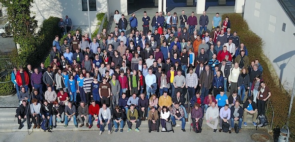
Group photo from the last FOSSGIS conference in Passau, Germany

Unlike most other OSMF local chapters, FOSSGIS e.V. has not been incorporated solely for that purpose. They do other things unrelated to OpenStreetMap, for example supporting projects like QGIS, GRASS, deegree, and their respective communities and meetups, or doing work focused on making Open Source GIS software popular in universities. They are also a local chapter of OSGeo.

We’re looking forward to a prosperous collaboration with FOSSGIS e.V.!

Welcome OpenStreetMap France

OpenStreetMap FranceWe’d like to welcome OpenStreetMap France (openstreetmap.fr) as an official OpenStreetMap Foundation Local Chapter.

OpenStreetMap France was established back in 2011 as an independent non-profit voluntary association, and over the years they have achieved great things, including organising hosting (with some funding and donated resources) of some important services, not just for the French users, but for the global OpenStreetMap ecosystem:

Of course they also host the openstreetmap.fr website, for which a new version is under development, and a French-speaking forum, and they support projects like OpenLevelUp, Caribe Wave/HAND, and Jungle Bus.

But beyond hosting things, they’re also a general advocacy organisation for OpenStreetMap in France, seeking to liaise with other associations, citizens, local governments, small and big companies, national mapping agency, postal services and anyone seeking an entry point within the OSM project and community.

A few months ago they were formally recognised as a OpenStreetMap Foundation Local Chapter.

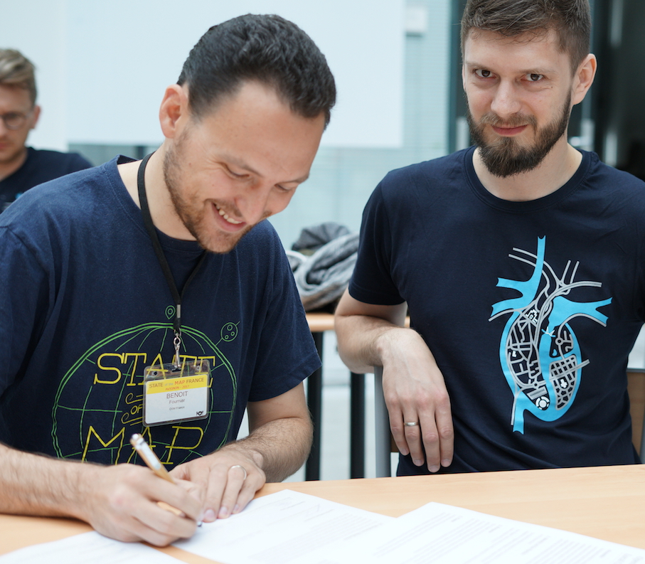
Benoit Fournier is signing the Local Chapter agreement

Benoît Fournier of the OSM France and Ilya Zverev of the OSMF Board are signing the Local Chapters Agreement at FOSS4G Europe 2017 in Paris, photo by Jody Garnett with license CC-BY,

Additionally an OSMF Advisory Board seat was accepted by Christian Quest from OpenStreetMap France.

This makes five local chapters formally established by the foundation, and there are more to come!

If you’d like to know more about OpenStreetMap France, contact them directly or discuss with the community on the ‘talk-fr’ mailing list. Or if you’d like to meet face-to-face, check out the SotM-France local conference. Now in its 6th year, in 2018 it will be taking place in Bordeaux June 1st-3rd

OpenStreetMap receives $25,000 Grant from American Red Cross

The OpenStreetMap Foundation is very excited to announce that the American Red Cross extended OSMF an USD 25,000 grant for purchasing hardware to support the ongoing resilience of the OSM platform infrastructure. The funds were allocated towards the purchase and provisioning of a ‘hot’ backup database failover server – which has been purchased and is currently humming along doing its important job! This trail-blazing contribution will ensure that we can recover from site failures quickly and with the minimum amount of disruption for those editing the map. This is a big step forward in platform resiliency that we otherwise would not have been able to make at this time.

American Red Cross and OpenStreetMap

The American Red Cross has steadily ramped up its support for OpenStreetMap. Indentifying OSM as a source of up-to-date map data crucial to their international disaster field operations, they quickly developed into a major contributor to OSM, through their own work, support of the Humanitarian OpenStreetMap Team (HOT), and most recently through their Missing Maps initiative, to which around 10% of all OSM map contributions can now be attributed. The American Red Cross has also supported OpenStreetMap through app development and sponsorship of State of the Map conferences.

If you are interested in the technical specifications of this new server, please see here.

We want to say a big Thank You to the American Red Cross and we hope that more organisations which use OSM data will be inspired to strengthen the OSMF infrastructure and support our great project! If you are interested in donating to the OpenStreetMap Foundation, please get in touch with us at board@osmfoundation.org.

About The OpenStreetMap Foundation

The OpenStreetMap Foundation is a not-for-profit organization, formed in the UK to support the OpenStreetMap Project. It is dedicated to encouraging the growth, development and distribution of free geospatial data and to providing geospatial data for anyone to use and share. The OpenStreetMap Foundation owns and maintains the infrastructure of the OpenStreetMap project. You can support OpenStreetMap by becoming a member, donating or joining our volunteer Working Groups.

About the American Red Cross

The American Red Cross shelters, feeds and provides emotional support to victims of disasters in the US; teaches skills that save lives; provides international humanitarian aid; and supports military members and their families. In 2017 alone, the American Red Cross sent humanitarian aid to 26 countries to help save lives in the aftermath of disasters. The Red Cross is a not-for-profit organization that depends on volunteers and the generosity of the American public to perform its mission. Visit redcross.org/international of more information.

Welcome 254 new members to the OpenStreetMap Foundation

Welcome to Foundation! We have cake 🙂 (2011 OpenStreetMap Anniversary Birthday party celebration in Toronto)

In September, we asked you to raise your hand and join the OpenStreetMap Foundation. And the OpenStreetMap community responded like never before.

During the membership drive, 254 new members joined the OSMF. An additional 100 people decided to renew their membership. This is the largest increase in membership in the history of the Foundation. This strong response shows us the value of active promotion of the role of the Foundation in the OSM community.

We are very excited to see the energy and enthusiasm of all our members. There are many ways to get involved.

Welcome!