Foursquare chooses OpenStreetMap

The social location check-ins application FourSquare has 15 million
users worldwide, and now they are using OpenStreetMap! The foursquare
website now features lovely custom rendered OpenStreetMap maps.

We ultimately ended up switching because, after all our
research and testing, OpenStreetMap and MapBox was simply the best fit
for us

http://blog.foursquare.com/2012/02/29/foursquare-is-joining-the-openstreetmap…

This will surely be a great boost to OpenStreetMap contribution too,
as people spot areas where the map needs to be improved. Foursquare
users, welcome to the OpenStreetMap community.

Help find who killed Ulf

We had sad news in January that our friend Ulf had been murdered in
Germany. Ulf’s family have asked if we can help find those who
murdered Ulf? Please see the up-to-date reports, and photos of
suspects:

http://ulf-m.blogspot.com

And please circulate. Help find Ulf’s killer(s).

We’re asking for the OSM community’s help. The people who
killed Ulf haven’t been found yet, very probably because they left the
country the morning after the crime. East European mappers, especially
from Lithuania or Poland, might have seen them, or they might at least
know about message boards in their language where the pictures and
description can be posted.

At http://ulf-m.blogspot.com, there are now English, Lithuanian and
Russian language versions, a Polish Version will follow. We are
thankful for any help in circulating our appeal in any appropriate
form.

Weekly OSM Summary #36

January 30th, 2012 – February 13th, 2012

A summary of all the things happening in the OpenStreetMap (OSM) world.

  • The “License Change View” of the OSM Inspector is updated every four hours now.
  • Several OSM Users reported that the Bing aerial imagery has been updated or that new images have been added. Read more here.
  • OSM data and Garmin GPS Maps for Syria generated on an hourly basis are available now. Based on the Bing aerial imagery you can add missing streets.
  • A Hack Weekend will take place in March in Toronto. Get more information here.
  • Belarus has a new OSM Project page now too: openstreetmap.by
  • Some OSM users noticed that several military areas in Germany are now masked in the German Bing aerial images. According to Steve Coast, a German agency requested this.
  • The Tiles @ Home server will be shut down by the end of February 2012. A big thank you for hosting this service in the past! Read the full announcement here.
  • A new JOSM-Plugin speeds up the download time of OSM data. Read more about it here.
  • On OSMRanking you can create daily updated rankings based on your edits in the OSM database. You can find an example of the “Members of the OSM Foundation Board” here.
  • Steve Kay created an OSM Tag Network of Edinburgh.
  • Lanyrd.com shows upcoming events on an OSM Map now. For instance the German FOSSGIS & OSM Conference 2012 in Dessau
  • With Active.com and Toursprung two additional websites switched from Google to OpenStreetMap.
  • A video of Patrick Meier’s presentation about “Crisismapping” at the re:publica XI: “Changing the World, One Map at a Time“. Also, a video of a presentation by Richard Cantwell at the Ignite Dublin about OSM and in particular about Haiti can be found here.
  • Around the Alps in 80 days“ a mapping project for the summer of 2012.
  • A nice Blog Post about “OpenStreetMap Philippines: 2011 Year in Review” by Eugene Alvin Villar.
  • An iOS App for OpenSeaMap is available now.

Did we miss something? You can contact us via weekly.osm@googlemail.com

Authors: Pascal & Dennis – (thx @ “Wochennotiz”)

Contact and Remap

A message from Michael Collinson and the Licensing Working Group


“Hi everyone,

We ask OSM mappers to check their local mapping areas, try and contact anyone who has not decided about re-licensing and then do as much remapping as you can. Please do this in good faith and not just copy things created by contributors who have declined or undecided! You can use information contributed by continuing mappers, resources like Bing imagery and your own knowledge. If you are mapping in Poland or the Czech Republic, please also note that we are aware of special issues that makes this difficult for you right now.

We would like to switch over licenses in two months time. In order to do that, un-relicensable data has to be removed from the active database, though it will remain in publicly available archives. The latest indications are that 1.9% of ways will likely not survive the license change and a further 0.6% may have to be reverted back to an earlier state.

We would like to decrease that still further.


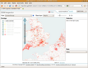
Your mapping area may be much worse or much better. You can use the license change view on OSMinspector and zoom into your area (Information on this tool). You can then click on Potlatch or JOSM icons to find out more and to do remapping. More info

We ask that you look at your areas and contact undecided mappers via the OpenStreetMap messaging system or directly if you know them. So that they do not get bothered too many times, please log who you contacted on this wiki page

This page also has example messages in different languages. Ask undecided mappers to please log into their account and accept even if they no longer wish to continue mapping as their previous contribution is important to you. Contact from someone mapping in the same area is very useful.”


The text of this posting can also be found at Remapping/Contact And Remap Campaign. Please feel to simplify it to help non-native English speakers and to translate it into other languages.

Original mailing list post

Weekly OSM Summary #35

January 16th, 2012 – January 30th, 2012

A summary of all the things happening in the OpenStreetMap (OSM) world.

  • On Tuesday, Feb. 7th, 2012 the Night of the Living Maps will take place. It is a global Mapathon. Get more information here.
  • The new webpage http://switch2osm.org is online! It helps you to switch your application to OSM (go figure). Ushahidi also uses OSM as their basemap now.
  • The License Working Group (LWG) wrote about the license change here and a new mailing list for the “Remapping Process” has been created.
  • The design and layout of the Humanitarian OpenStreetMap Team (H.O.T.) webpage has been updated. Also, a HOT presentation by Richard Welty can be found online here.
  • On February 25th and 26th a Hacking Weekend will take place in Karlsruhe, Germany.
  • With MapBox light a new online service has been published to use OSM maps for the visualization of different data. Read more here. Also, a minimalist OSM baselayer for MapBox.
  • A map of Ireland showing hospital accessibility using an OSM basemap and Flex.
  • Summary of all Stamen Maps which were created in 2011 based on free geodata.
  • Andy Allan created a new Snapshot Server. It is a new and simple solution to use OSM data in overlays.
  • An Open Source iOS App has been published. Read more here.
  • An article explaining how to use R or more specifically the Maptools library instead of ArcMap. You can use the osmar package in R too.
  • The new Red Sea volcanic island of the Zubair Group is already digitized in OSM.
  • Want to create your own OSM key fob? Watch this.
  • An article about OSM in Bangladesh.

Did we miss something? You can contact us via weekly.osm@googlemail.com

Authors: Pascal & Dennis – (thx @ “Wochennotiz”)

OpenStreetMap and Indoor Maps [Part 2/2]: The mapping proposal for OpenIndoorMaps [by Marcus Götz]

Ijfbgjjc

Following our first post on the challenges and opportunities of an indoor-extended OpenStreetMap, we now wish to concentrate on the specifics and provide a proposal for “OpenIndoorMaps”. Before doing this, we provide some use-case scenarios that our proposal addresses.

Use-Case scenarios for OpenIndoorMaps

There are many possibilities or use-case scenarios for indoor maps or services such as routing or navigation. Imagine being a businessman at the airport: after entering the entrance hall you first want to go to the check-in counter and then to a nearby newspaper shop before searching for the lounge and then finally going to the gate. Normally you have to do this “navigation” by yourself, which can be quite a challenging task (especially in huge airports such as Chicago or Beijing).

Another example is the following: you are visiting a huge shopping mall. Unfortunately you do not have much time, thus you need proper guidance inside the mall. Luckily, you have your OSM based indoor routing application on your mobile phone, which means that you can easily locate your desired shop or item and receive proper routing instructions inside the mall. Besides these two use-cases there are plenty of other scenarios such as navigation in hotels (imagine being in Dubai in the Burj Khalifa with more than 100 floors or in the Venetian Resort in Las Vegas with more than 7000 rooms), in universities, in museums, train stations and so on.

As you can see, there are many meaningful examples of why indoor information is so important.

The indoorOSM model proposal

Basically, a building is represented as a feature (technically as a “relation”), whereby an attribute characterises it as building. One of the well known features of OSM is the fact that all kinds of additional building information such as the name or type can be attached to it. Every floor within the building is assigned a floor level while every entrance or exit of the building receives a unique ID in order to create a connection between the outdoor world and the indoor. Each floor is then assigned a corresponding level, (“floor-relation member”) such as level_0, level_1, level_-1 and so on (level_0 always denotes the ground floor).

Each floor of a building (technically each relation-member of the main relation) is again mapped separately, whereby a specific floor level is selected during the editing session.

Different building parts of a floor are mapped as room, hall, corridor, and so on. Each part of the building can contain features such as windows which can be described (tagged) in detail. Vertical connections are mapped as elevators, stairways and so on. A vertical connection can be connected to several levels (e.g. an elevator) or a single level (stairs).

Extend the model to your needs!

A full technical description can be found here: http://wiki.openstreetmap.org/wiki/IndoorOSM. Please do not hesitate to come up with proposals on how to improve and extend the model!

Start mapping a building yourself!

Start mapping a building yourself: Just open the JOSM editor, zoom to the location where the building is and start mapping the level shell as well as the building parts of one level (for example the ground level), and finally combine them in a relation. Afterwards, you can hide this relation (thus all ways will be invisible) and start with the next floor. When you have finished mapping all of the floors, simply create the building relation and add all floor-relations as relation-members.

Look at your result!

Currently, there is no automated integration process of indoor maps into http://indoorosm.uni-hd.de. Therefore, if you have mapped a building, simply send a short notification to m.goetz [at] uni-heidelberg.de (mentioning the relation id of your building) and your map will be integrated as fast as possible.  In the long run, a version with automated building integration can also be developed – assuming that there will be more and more building mapped indoors.
Ulf Möller

The OpenStreetMap Foundation has learned of the death of our friend and colleague, Ulf Möller.

Update: Help find the killer

Ulf’s family have asked if we can help find Ulf’s killer(s)? Please see the photos of the murder suspects and help if you can.

Ulf Möller, 1972 - 2012

Ulf discovered OpenStreetMap in 2007 and mapped in Munich and Hamburg as well as in other countries. He was the first German elected to the OpenStreetMap Foundation Board in 2009/2010 and served on the License Working Group with attention to detail, concern for the German OpenStreetMap community and courteous persistence.

The OpenStreetMap Foundation Board offers sincere condolences to Ulf’s family on behalf of the OpenStreetMap community. We are saddened and shocked by his untimely death.

The family has requested privacy at this difficult time. Please use the comments in this post to share your memories of Ulf and condolences for the family. They will know where to find them when they are ready.

Ulf’s family has kindly provided the above photograph of Ulf as we will remember him; Smiling, happy, cycling, and apparently mapping with his GPS.

Weekly OSM Summary #34

January 2nd, 2012 – January 16th, 2012

A summary of all the things happening in the OpenStreetMap (OSM) world.

  • The State of the Map (SotM) Conference 2012 will be held in Tokyo. Congrats Japan!
  • The call for bids to host the State Of The Map US Conference is out now.
  • The first US OSM Hack Weekend will take place in Washington on February 18th and 19th.
  • Toby wrote a blog post about “License Change Mapping” a.k.a. Remapping.
  • Simon’s CLEANMAP has a second new layer. The BADMAP now displays all data which will likely be removed after April 1st, 2012.
  • A big “Thank you!” to all volunteers who supported the World Health Organization (WHO). Read the full letter here.
  • StreetEasy.com is another webpage, which recently switched to OSM. You can find a general article here and a more technical one here.
  • Wired.com published an article on how to switch to OSM.
  • Pascal, Dennis and Alexander conducted several analyses regarding “OpenStreetMap in Germany 2007-2011”. Their study has been published as an open access paper.
  • OSM Israel uses the OSM Germany webpage design now too.
  • The new WordPress Plugin “MapsMaker” integrates an OSM map into your blog.
  • Rob wrote a really nice tool to create a HTML report for your GPS/GPX track. You can find more information on his webpage and his project on github.
  • The aerial imageries of the GeoEye’s OrbView-3 satellite are Public Domain. For more details on how to use them, read the announcement here.
  • Gael presented the OSM project to the French senate. Watch the video (in French) here.

Did we miss something? You can contact us via weekly.osm@googlemail.com

Authors: Pascal & Dennis – (thx @ “Wochennotiz”)

Google IP Vandalizing OpenStreetMap

Last week Mocality, a Kenyan business data startup, caught Google scraping their data and the post made it to boing boing. Mocality tracked this down with some analysis of their logs and a sting operation, even recording phone calls that Google staff made which contained false information. Google have apologized and the incident looked closed, at least from the outside.
 
Unfortunately we have to report something similar is still happening to us from the same source.
 
Preliminary results show users from Google IP address ranges in India deleting, moving and abusing OSM data including subtle edits like reversing one-way streets.
 

Two OpenStreetMap accounts have been vandalizing OSM in London, New York and elsewhere from Google’s IP address, the same address in India reported by Mocality. 

The most obvious vandalism started around last Thursday last week from these particular users however it may take us some time to do a full analysis. In fact over the last year we have had over 102 thousand hits on OSM using at least 17 accounts from this Google IP. 

These actions are somewhat baffling given our past good relationship with Google which has included donations and Summer of Code work. As a community we take the quality of our data extremely seriously and look forward to an explanation from Google and an undertaking to not allow this kind of thing to happen in the future.

Mikel Maron, OSMF board member, mikel@osmfoundation.org
Grant Slater, OSM Sysadmin, grant@osmfoundation.org
Steve Coast, OSM Founder, chairman@osmfoundation.org


—————–


Update 17th Jan 2012 5:30pm GMT
We’ve had many questions since this was posted and wanted to fill in some blanks.
 
Why was the post made? As an open community we respect the privacy of our members. We have to draw a line somewhere between open and closed communications not being available to community members. It was felt on balance that making the minimum facts public was the right thing to do.
 
What more details can we share? The source IP range: 74.125.63.* and two of the investigated accounts are: http://www.openstreetmap.org/user/kane123 (This user was blocked for a day on Friday… and they continued vandalising on Monday after being made aware of their bad edits Source: http://www.openstreetmap.org/user_blocks/79 ) and http://www.openstreetmap.org/user/sanganabongina 
 
Do you have an example of malicious data? Yes, here: http://www.openstreetmap.org/browse/changeset/10375538 (London), http://www.openstreetmap.org/browse/changeset/10375581 (New York City) where a user from that IP address modified one way streets [reversed and deleted]. Here: http://www.openstreetmap.org/browse/way/145893931/history where a user added a fake Olympic stadium.
 

Have we spoken to Google? We are talking to Google and sharing all the information we have. 

Do we know if this was a coordinated activity? No. We simply know the IP address and the accounts and edit information, we’re not implying a grand conspiracy. The edits were made over many hours over multiple days – nothing that would happen as an accident by a new user. 

When and how is vandalism escalated? – Our vandalism policy is here: http://wiki.openstreetmap.org/wiki/Vandalism 

Was this all overblown? As a very diverse and large community of over 500,000 user accounts we have a wide set of opinions even amongst the key people running OSM. This is welcomed and every member of our community is free to speak about how they see things.